Regional Weather
Weather forecasts, marine conditions and observation data for Niue, Kiribati, Nauru, Tokelau, Tuvalu and Cook Islands.
Niue
Niue
Weather Bulletin issued from NWFC Nadi Apr 040221 UTC.
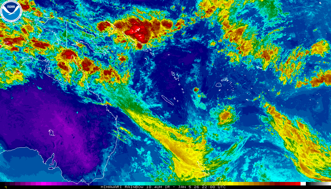
Situation: A trough of low pressure with associated cloud and showers affects Niue. Meanwhile, a moist northwesterly wind flow prevails over the group.
Forecast to midnight tomorrow for Niue: Cloudy periods with some showers and isolated thunderstorms. Moderate east to northeasterly winds. Moderate seas.
Further outlook: Fine apart from brief showers.
Marine Weather Bulletin for Niue
Forecast to midnight tomorrow for all Niue water: East to northeasterly winds 10 to 15 knots. Moderate seas. Moderate southerly swells. Further outlook: Southeasterly winds 10 to 15 knots. Moderate seas. Moderate southerly swells.
Niue
Niue
Weather Bulletin issued from NWFC Nadi Apr 040221 UTC.
Situation: A trough of low pressure with associated cloud and showers affects Niue. Meanwhile, a moist northwesterly wind flow prevails over the group.
Forecast to midnight tomorrow for Niue: Cloudy periods with some showers and isolated thunderstorms. Moderate east to northeasterly winds. Moderate seas.
Further outlook: Fine apart from brief showers.
Marine Weather Bulletin for Niue
Forecast to midnight tomorrow for all Niue water: East to northeasterly winds 10 to 15 knots. Moderate seas. Moderate southerly swells. Further outlook: Southeasterly winds 10 to 15 knots. Moderate seas. Moderate southerly swells.
Kiribati
Kiribati and Banaba
Weather Bulletin issued from NWFC Nadi Apr 040054 UTC.


Situation:
The Inter-Tropical Convergence Zone [ITCZ] affects the northern parts
of Northern Line Islands. A trough of low pressure affects Western
Kiribati. Meanwhile, an east to southwesterly wind flow prevails over
the group.

Forecast to midnight tomorrow for Kiribati
Moderate to fresh east to southwesterly winds.
Moderate to rough seas.

Western Kiribati: Occasional showers and isolated thunderstorms.
Northern Line Islands: Some showers about and north of Fanning
island. Mainly fine elsewhere.
Phoenix Islands: Fine apart from brief showers.
Southern Line Islands: Cloudy periods with some showers.
Further outlook:    Western Kiribati: Occasional showers and isolated
thunderstorms.
Northern Line Islands:  Some showers and isolated thunderstorms over
Northern parts. Mainly fine weather elsewhere.
Phoenix Islands: Fine apart from brief showers.
Southern Line Islands: Cloudy periods with some showers and isolated
thunderstorms.

For Tarawa:
Occasional showers and isolated thunderstorms.
Further outlook:    Occasional showers and isolated thunderstorms.

For Banaba:
Situation: A trough of low pressure affects Banaba.

Occasional showers and isolated thunderstorms.
Moderate to fresh southwesterly winds.
Moderate to rough seas.
Further outlook:    Occasional showers and isolated thunderstorms.
Tuvalu
Tuvalu
Weather Bulletin issued from NWFC Nadi Apr 040054 UTC.
A STRONG WIND WARNING REMAINS IN FORCE FOR TUVALU WATERS.

Situation:
An active trough of low pressure with associated cloud and rain
continues to affect Tuvalu.

Forecast to midnight tomorrow for Tuvalu:
Over Waters: Northeasterly winds 20 to 25 knots, gusting up to 30
knots at times.
Over Land: Moderate to fresh northeasterly winds.
Rough seas.
Moderate northeasterly swells.

Occasional rain, heavy at times and few thunderstorms.


Further outlook:    Cloudy periods with some showers and isolated
thunderstorms.

For Funafuti:
Occasional rain, heavy at times and few thunderstorms.
Further outlook:    Cloudy periods with some showers and isolated
thunderstorms.
Tokelau
Tokelau
Weather Bulletin issued from NWFC Nadi Apr 040054 UTC.


Situation:
A weak trough of low pressure with associated cloud and showers
affects Tokelau.

Forecast to midnight tomorrow for Tokelau:
Cloudy periods with some showers and isolated thunderstorms.
Moderate to fresh easterly winds.
Moderate to rough seas.

Further outlook:    Cloudy periods with some showers and isolated
thunderstorms.
Nauru
Nauru

Weather Bulletin issued from RSMC Nadi Apr 040054 UTC.

Situation:
A trough of low pressure with cloud and showers lies slow moving near
Nauru.

Forecast to midnight tomorrow for Nauru:
Occasional showers and isolated thunderstorms.
Moderate to fresh southwesterly winds.
Moderate to rough seas.

Further outlook:    Occasional showers and isolated thunderstorms.
Cook Islands
Northern and Southern Cooks
Weather Bulletin issued from NWFC Nadi Apr 040221 UTC.


Situation:
A weak trough of low pressure lies within the vicinity of Southern
Cooks. Meanwhile, a moist northeasterly wind flow prevails over the
group.

A moist easterly wind flow prevails over Northern Cooks.

Forecast to midnight tomorrow for the Southern Cooks:
Cloudy periods with brief showers.
Moderate to fresh northeasterly winds.
Moderate to rough seas.

Further outlook:    Cloudy periods with some showers and possible
isolated thunderstorms.

For Rarotonga:
Cloudy periods with brief showers.
Further outlook:    Cloudy periods with some showers and possible
isolated thunderstorms.

For the Northern Cooks:
Mainly fine weather.
Moderate to fresh easterly winds.
Moderate to rough seas.

Further outlook:    Cloudy periods with some showers and isolated
thunderstorms.